
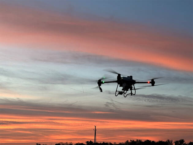
In recent times, drones with GPS and cameras have revolutionized various industries, from filmmaking to surveying, providing unparalleled advantages and features. The integration of these technologies offers accuracy, functionality, and versatility, enabling enthusiasts and professionals alike to explore new dimensions. Whether you are capturing scenic landscapes or conducting a detailed inspection, understanding the capabilities of drones equipped with GPS and a camera will help you maximize their potential.
Enhanced Navigation and Precision
Drones with GPS capabilities allow precise navigation and positioning, making them ideal for tasks requiring exact coordinates. GPS enables users to set desired waypoints, ensuring the drone follows a specified path, which is crucial for mapping applications and makes the process smooth and efficient.
Captivating Visuals
Cameras equipped on drones have evolved to offer high-resolution imaging, exceptional color accuracy, and enhanced clarity. These features are crucial for professional photographers and videographers who need quality footage and images. Additionally, drones are often equipped with advanced stabilization systems, ensuring crisp and smooth shots even in windy conditions.
Drones with GPS and camera functionalities are particularly beneficial in real estate, allowing aerial imagery that showcases properties from unique perspectives. Such technology transforms promotional materials, providing potential buyers with a detailed view of the site.
Applications Across Various Industries
- Filmmaking – Capturing breathtaking aerial shots efficiently.
- Surveying and mapping – Obtain precise data and streamline operations.
- Agriculture – Assess crop health and monitor large fields.
- Disaster management – Provide critical visuals for strategic planning.

User-Friendly Technologies
Modern drones often come with intuitive apps and interfaces, making them accessible even to those unfamiliar with technical operations. GPS-equipped drones can be programmed for autonomous flight paths, reducing the need for manual control and mitigating human error.
Safety Features
Drones integrating GPS are equipped with return-to-home features, which automatically navigate the drone back to its starting point if the battery runs low or connectivity is lost. Such safety measures are essential to prevent loss and ensure the longevity of the device.
An additional plus is geo-fencing, which designates restricted areas and prevents drones from entering potentially hazardous zones.
Cost Efficiency and Investment
While the initial investment for drones with GPS and camera capabilities might be significant, their versatility and wide range of applications can lead to substantial savings and productivity improvements. They have proven beneficial in reducing the time and effort required for traditional data collection methods.
FAQs about Drones with GPS and Camera
How does GPS improve drone functionality?
GPS enhances drone usage by allowing precise navigation, establishing flight paths, and enabling automated return-to-home functions.
What should I consider when buying a drone with a camera?
Key considerations include camera resolution, stabilization features, battery life, and ease of use with existing software.
Are drones with GPS more expensive?
Generally, they are costlier due to additional technological integrations, but the benefits in navigation and safety justify the investment for many users.
With these technological enhancements, drones equipped with GPS and cameras are not only tools but also gateways to creativity and efficiency across diverse sectors.